1
of9
Chapter
No
No
Geography
Canadian Geography
Canada is the second-biggest country on earth, yet over 80 per cent of its land is uninhabited, and most Canadians live clustered in a handful of large cities close to the U.S. border. This reality stems from Canada’s unique geography, which is, all things considered, rather unfriendly to humans.
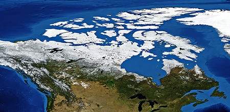
VanHart/Shutterstock
Canada, as viewed from outer space.
The Canadian Landmass
Canada occupies the top half of the North American continent, where it borders the United States — Canada’s only neighboring nation — to its south (and north-east, via the isolated state of Alaska). Canada’s national motto, a Mari Usque ad Mare, or “From Sea to Sea,” captures the vastness of the nation, as the country quite literally stretches from the Pacific Ocean on its western coast to the Atlantic Ocean on its east. Some have even suggested adding a third “…to Sea” in the motto to reflect the fact the country reaches high enough north to touch the Arctic Ocean as well.
The story of Canadian geography unfolds in two directions: west to east and north to south. The more north you go, the colder, rockier, snowier, and overall less suitable for living the country gets, which explains why few people go through the hassle. From southeast to southwest lies the more livable portion of the country with enormous geographic diversity — everything from lush green valleys to dry, sandy deserts.
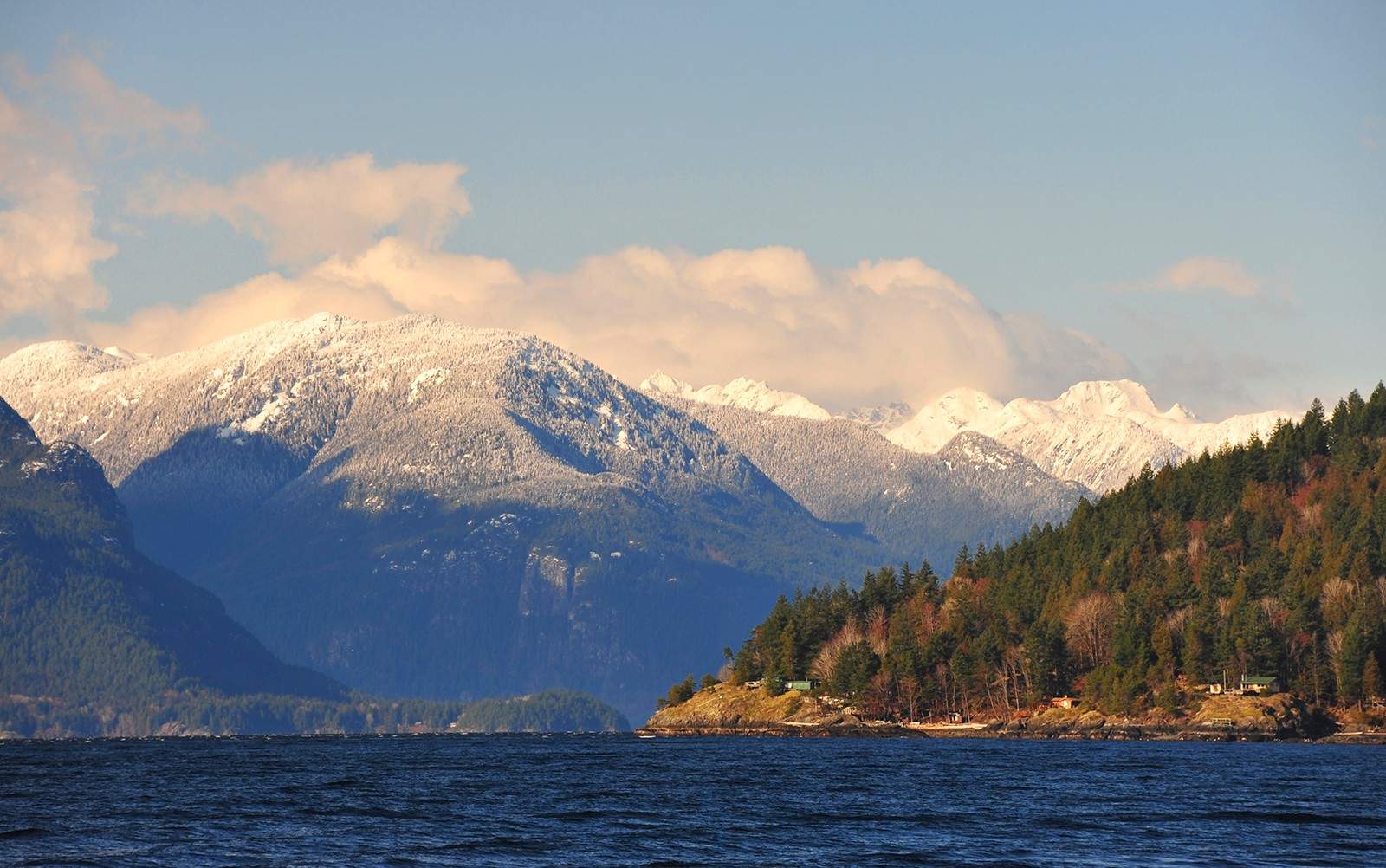
The view from British Columbia's Sunshine Coast, looking out on the Strait of Georgia.
kathmanduphotog/Shutterstock
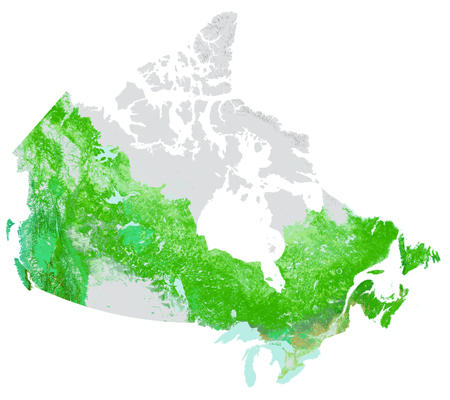
Natural Resources Canada
Trees in Canada
A map showing the distribution of forested areas across Canada. Note the barren pocket in southwestern Canadian prairies and the far north.
The West Coast
Canada’s West Coast is the westernmost part of the country that borders the Pacific Ocean. It is known by geographers as the Cordillera region, and contains the province of British Columbia. The shape of Canada’s border with the Pacific is defined by the Coastal Range mountains which stretch down from Alaska and are located very close to the ocean’s edge.
Moving east, away from the Pacific, is Canadian portion of the Rocky Mountains, which forms British Columbia’s border with the province of Alberta. Both ranges are home to massive evergreen forests and a diverse assortment of wildlife that have historically formed the world’s stereotypical image of Canadian nature.
Between the two Pacific mountain ranges lie rich, green valleys as well as a small, warm, dry region in the southern interior of British Columbia known as the Okanagan. Insulated by the mountains, this desert-like area has proven a hospitable climate for growing fruit and vegetables, making it a natural home for some of Canada’s largest orchards and wineries.
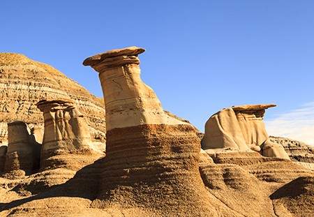
The rocky terrain of the Canadian Badlands in Drumheller, Alberta.
The Canadian Prairies
Beyond the rocky mountains, Canada’s landscape dramatically flattens. This vast territory, known as the Prairies, contains the provinces of Alberta, Saskatchewan and Manitoba, and houses some of the driest, least-forested parts of the country. Wide-open fields and flat, arable land make the region the base of Canadian agriculture. Parts of southeastern Alberta are quite barren, however, with an arid, desert-like landscape known for its rocky soil and hoodoos — massive gravity-defying stone formations.
Though often overlooked, the landscape of the northern Prairies is considerably more hilly and forested than the more famous plains of the southern prairies. The central part of the province of Manitoba is similarly dominated by three enormous lakes — Lake Manitoba, Lake Winnipegosis and Lake Winnipeg — which are surrounded by lush vegetation and swamps, rivers, and bogs.
At 129,656 square kilometres, Alberta's Wood Buffalo National Park is Canada's largest.
Dancestrokes/Shutterstock
Anjo Kan/Shutterstock
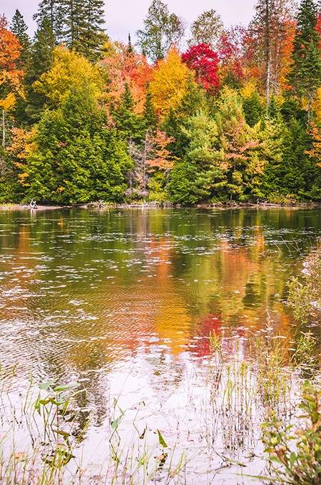
Eastern Autumn
Ontario's beauty is on display in the fall as leaves begin to change colour. Seen here, a lakeside in Algonquin Provincial Park.
Central Canada
Central Canada, containing the country’s two largest provinces, Ontario and Quebec, is part of a massive geographic land formation known as the Canadian Shield that gives much of the country its distinctive shape. Scooped out by the giant Hudson Bay to the north and bordered by four of the five Great Lakes — Lake Superior, Lake Huron, Lake Erie, and Lake Ontario — to the south, Central Canada (also known as the Laurentian region) is a mostly green landscape of rolling hills, grassy fields, and deciduous forests topped by a barren and rocky north.
Both Ontario and Quebec are dotted with thousands of small lakes and rivers, many of which are surrounded by moist wetlands home to iconic Canadian animals such as the beaver and moose. Most human residents of the region live in what is known as the Great Lakes-St. Lawrence Lowlands area, a stretch of low elevation and fertile farmland located around the coasts of Lake Ontario and the massive St. Lawrence River, both of which flow out into the Atlantic Ocean.
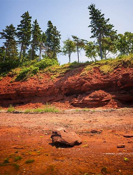
Elena Elisseeva/Shutterstock
Red Soil
Rich in iron oxide, the soil in the Canadian Maritimes is known for its distinctive red colour. Seen here, a beach in Cavendish, Prince Edward Island.
Atlantic Canada
Farthest east, we have the Appalachian region, encompassing the four Atlantic provinces of Newfoundland, New Brunswick, Prince Edward Island, and Nova Scotia, which are all either islands or peninsulas protruding from the eastern edge of Quebec and extending into the Atlantic Ocean.
A mix of rocky coasts and forested interiors, the landscape of Atlantic Canada, also known as the Maritimes, has been shaped by its proximity to the ocean, with steep cliffs, high tides, and long coastal fjords. Much of the interior is densely forested and low in elevation, though the Appalachian Mountain Range does extend into parts of northern New Brunswick and Newfoundland.
In contrast to other parts of Canada, the small Atlantic provinces are known for being densely populated, and only Newfoundland features large portions of entirely uninhabited land. Emptiest of all is the barren territory of Labrador, which although officially part of the province of Newfoundland, is a separate geographic territory located on the rocky northeastern tip of Quebec, and is home to the Torngat Mountains, Canada’s tallest range east of the Rockies.
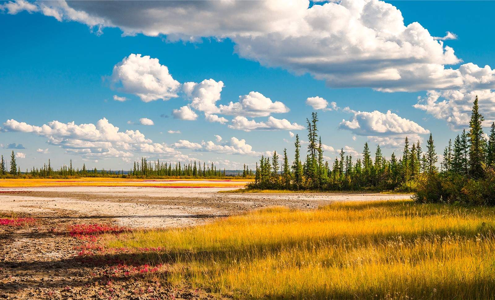
Northern Canada
The Canadian “north” is a somewhat vaguely-defined region. All the provinces, save the Maritimes, contain dry, largely barren and mostly uninhabited northern areas prone to long, cold winters, heavy snow, and perpetually frozen soil.
In a more specific sense, however, the capital-n North usually means the vast, northwestern half of Canada that contains the country’s three northern territories: Yukon, Nunavut, and the less creatively-named Northwest Territories. Though Yukon, on the far west, possesses a more forested, Cordillera-style environment in contrast to Nunavut and the NWT, all three most mostly rocky, barren terrain with only sparse vegetation.
The extreme north of Canada, where virtually no humans dare to trek, is an archipelago of massive islands covered by snowy tundra, vast, frozen glaciers, and towering mountains. Home to polar bears, seals, and narwhals — but very little plant life and almost no human beings — this unique and exotic region forms an important part of Canada’s image, even if it’s an area few will ever visit in person.
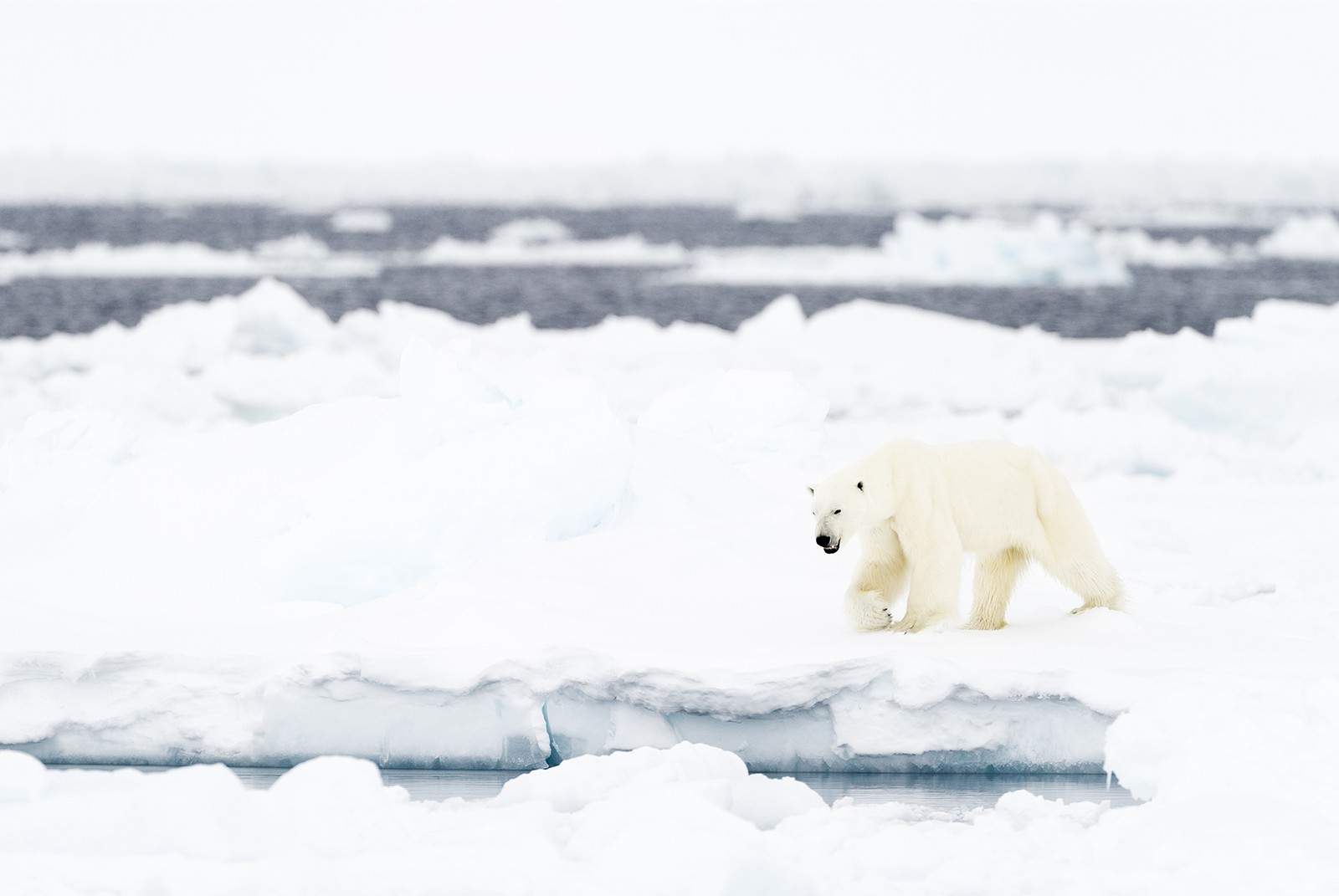
A polar bear walks on an ice flow in Nunavut's Baffin Bay.
AndreAnita/Shutterstock
Zhenwang Wang/Shutterstock
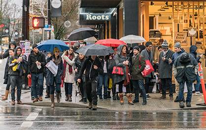
Shoppers in downtown Vancouver brave the winter rain.
Weather in Canada
Weather is a controversial topic with Canadians, born from a mix of frustration and defensiveness. On one hand, Canada is, undeniably, one of the coldest countries in the world, with temperatures in many cities dipping below -20°(C) in the winter (December-March), complete with heavy snowfalls, icy winds, and slippery, frozen streets. On the other hand, winter is only one of the country’s four seasons, and most inhabited parts of Canada also enjoy relatively mild autumns (September-December), pleasant springs (March-June), and warm summers (June-September). The common assumption of foreigners that Canada suffers through harsh cold all year round is a stereotype Canadians find irritating.
Canadians who live near the Atlantic or Pacific coasts usually experience minimal snow, but long, heavy periods of rainfall in the fall and winter, and a generally moist, grey climate. In the sunny Prairie region, rain is considerably rarer, but the dry air can occasionally prompt fierce thunderstorms and tornadoes — sometimes called Alberta Clippers. Central Canada has infamously cold, snowy winters, but these usually give way to wet springs and very hot, humid summers. Northern Canada tends to have the most extreme weather polarization of all, with as much as 24 straight hours of continuous sunlight in the summer, and near-perpetual darkness in the fall. Even in the North, however, there are still periods of relative warmth and green — at least in the areas where humans live.
Karl Naundorf/Shutterstock
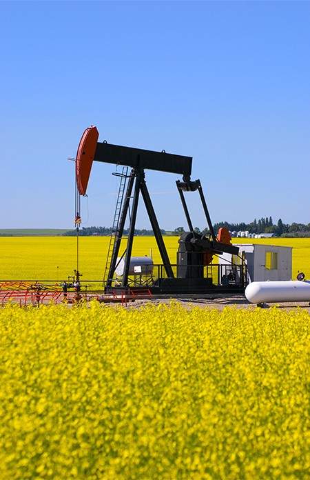
Nature's Bounty
A mixed-use field in southern Alberta used for both growing canola and pumping oil.
Canada’s Natural Resources
Canada’s status as one of the earth’s richest nations is hardly a mystery. There exist very few valuable minerals, chemicals, or elements that can’t be found in at least some part of Canada, giving the country a huge abundance of precious natural resources to sell.
Most famously, the Prairie province of Alberta is home to some of the largest deposits of oil and natural gas on the American continent, a fact which has allowed Canada to emerge as one of the 21st century’s major energy-producing superpowers. The province also contains the world’s largest proven oil sands (or bitumen) reserves, a fact which, if added alongside the country’s traditional petroleum reserves, puts Canada in a firm second-place behind Saudi Arabia as the world’s most oil-rich nation.
All provinces and territories (save tiny Prince Edward Island) have ample mineral mines, though what’s harvested varies from province to province. Canada is one of the world’s leading producers of zinc, which is found in most parts of the country, as well as uranium and potash, which are mined mainly in Saskatchewan. Large amounts of nickel and copper are found in Northern Ontario and Manitoba, while iron and coal have been traditional staples of the Atlantic region. Gold has historically been found just about everywhere, while diamonds are becoming big business in Canada’s North. Controversially, Canada has also remained one of the world’s most active producers of the dangerous insulator known as asbestos, which is mainly mined in Quebec and sold to poor countries with lax public safety laws.
Provinces and Territories
The nation of Canada is divided into 13 sub-national units, or subdivisions. 10 are called provinces, while the remaining three are called territories. Historically, territories did not have self-government and were administered directly by the federal government in Ottawa, but this is no longer the case today, and there are no longer any meaningful political differences between a “province” and “territory” other than name.
Canada’s provinces and territories are some of the largest subdivisions of any country in the world, bigger than many individual countries. They also have some of the lowest levels of population density of anywhere on earth, however, given that much of northern Canada is very sparsely inhabited. Upwards of 90% of Canadians live within 160 kilometres of the U.S. border, which is mostly located at the earth’s 49th longitudinal parallel.
For more information on Canada’s provinces and territories check out the following chapters:
More About Canadian Geography
Canada West Mountain School
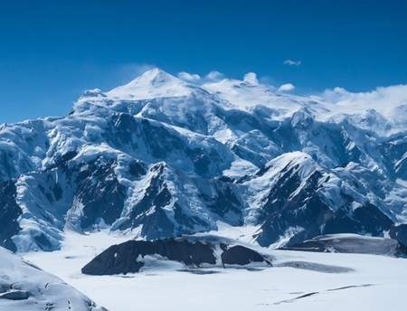
Canadian Mountains
Canada's tallest peak, Mount Logan, is the second-highest mountain in North America, and is located close to the Yukon-Alaska border. Its highest point is 5,959 metres (19,551 feet). Canada's next four tallest mountains are all in the Yukon as well.
poemnist/Shutterstock
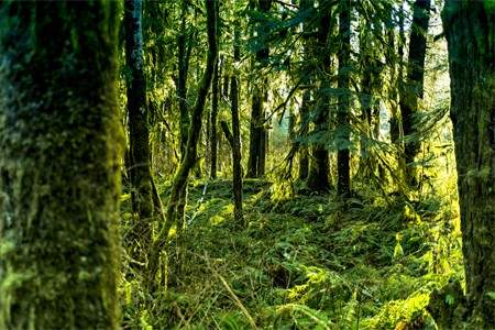
Canadian Forests and Trees
The old growth forests on the islands of British Columbia are home to some of the oldest, tallest trees in Canada. Seen here, a dense forest in Port Renfrew, British Columbia, located on the west coast of Vancouver Island. There are trees in Port Renfrew estimated to be over a thousand years old.
Canada West Mountain School
Canadian Mountains
Canada's tallest peak, Mount Logan, is the second-highest mountain in North America, and is located close to the Yukon-Alaska border. Its highest point is 5,959 metres (19,551 feet). Canada's next four tallest mountains are all in the Yukon as well.
poemnist/Shutterstock
Canadian Forests and Trees
The old growth forests on the islands of British Columbia are home to some of the oldest, tallest trees in Canada. Seen here, a dense forest in Port Renfrew, British Columbia, located on the west coast of Vancouver Island. There are trees in Port Renfrew estimated to be over a thousand years old.